Current Research
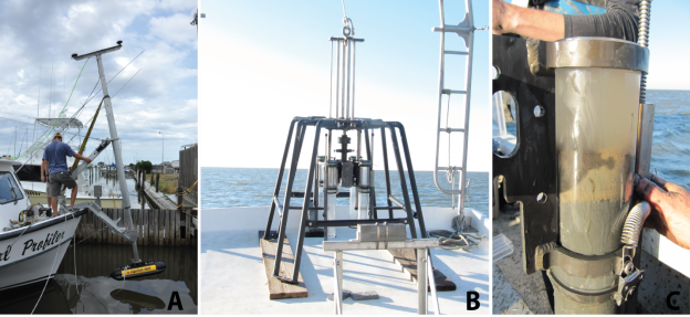
Operational Gulf of Mexico Hypoxia Monitoring
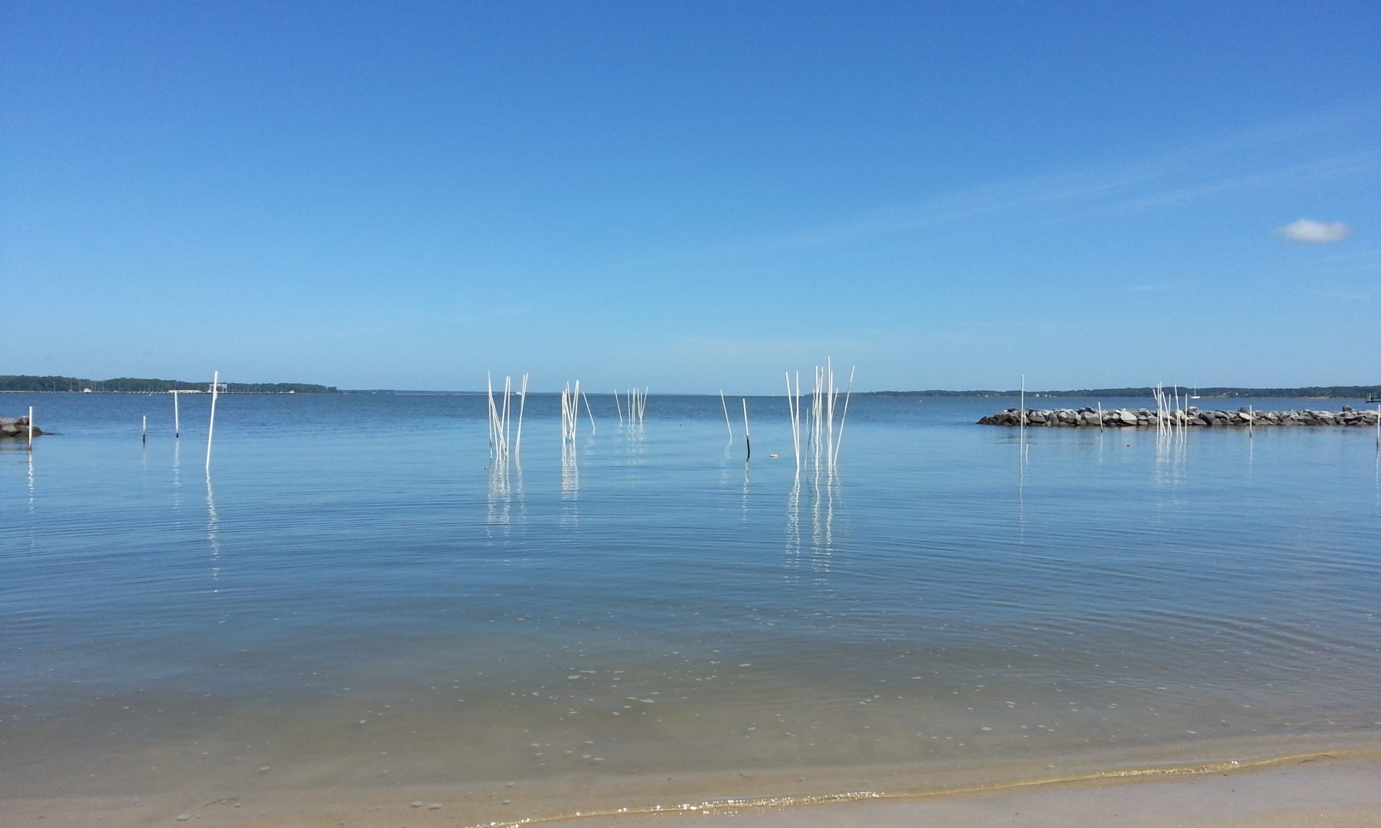
The northern portion of the Gulf of Mexico ecosystem, a region containing almost half of the nation's coastal wetlands and supporting commercial and recreational fisheries, has undergone profound changes due to nutrient enrichment of Mississippi River water from land-based sources. This over-enrichment of nutrients stimulates the development of seasonal hypoxia (waters with very low oxygen) over the Louisiana/Texas continental shelf during the summer, and results in the largest recurring hypoxic zone (or “dead zone”) in the United States. Hypoxic waters can cause habitat loss, stress, and even death to marine organisms, affecting commercial harvests and the health of impacted ecosystems. The goal is for the hypoxia monitoring cruise to become a successful example of how to transition research to operations, while continuing to provide the Gulf of Mexico Hypoxia Task Force with its key metric to measure the success of their Action Plan and to continue to support a key forecast of NOAA’s Ecological Forecasting Initiative (i.e., "Roadmap").
Biological Vulnerability to Hypoxia from Climate Warming and Eutrophication in the Northern Gulf of Mexico
The Gulf of Mexico annual hypoxia zone has been mapped since 1985. This long term mapping has allowed for documentation of the temporal and spatial extent of hypoxia, identification of the hydrographic, chemical, and biological variables related to the development and maintenance of hypoxia, and development of predictive models of the relationship between riverine nutrient loading and the size and severity of the hypoxic zone. These long-term observations provide a synthetic, interdisciplinary dataset that directly supports greater scientific understanding, improved predictive modeling, and policy development related to nutrient management within the Mississippi River Basin and natural resource management within the Gulf of Mexico. This project will add collection of nutrient data and monitoring of the hypoxic conditions east of the Mississippi River, expanding this annual survey area to better understand the Gulf of Mexico’s dead zone.
Enhancement of Hypoxia Monitoring in the Northern Gulf of Mexico
The northern Gulf of Mexico continental shelf hosts one of the largest coastal hypoxic zones, also called “dead zones,” in the world and continues to have widespread negative impacts on the marine ecosystem and species. The formation, evolution, and ecological impact of the hypoxic zone under current conditions are relatively well studied. However, the hypoxic zone under future conditions with the combined effect of climate warming, ocean deoxygenation, and nutrient inputs remains to be explored. Resource managers and stakeholders need knowledge and a framework suitable for the future northern Gulf of Mexico to plan nutrient reduction strategies aimed to minimize the hypoxic zone and evaluate the effects of the hypoxic zone on living resources within the context of a changing climate. The goal of the project is to provide a better scientific basis for policymakers and resource managers to develop policies on hypoxic zone management, habitat and fish stock assessment, and more general policies that account for the anticipated regional impacts of global climate change.
University-Led Offshore Analysis of Seafloor Instability and Sediments (OASIS Partnership) with Applications to Offshore Safety and Marine Archaeology
Gravity flows (GF) (or currents) in the Mississippi River Delta Front (MRDF) are known to displace large volumes of sediment mixed with seawater. These high-energy events have damaged infrastructure, causing multiple oil spills including the second largest oil spill in U.S. history. GF additionally have displaced shipwrecks hundreds of meters over short time periods, potentially impacting these wrecks and further endangering nearby oil and gas infrastructure. There is currently a limited understanding of the triggering mechanisms for GF, the dynamic processes at work once they are underway, as well as their frequency, power, and scale.This study will identify high, intermediate, and low-risk areas for future occurrence of GF. Key locations for detection of intermediate to large high-energy sediment transport events will be identified for deployment of monitoring equipment. New and existing data sets will be utilized to characterize sediments and physical oceanographic processes at selected locations in the MRDF, including known shipwreck locations; conduct baseline archaeological analysis at these sites; and test if in situ acoustic sensors could monitor potential future shipwreck displacement due to GF activity.
Louisiana Deltaic Estuaries MBON: Sea Level Rise Sentinels
The Marine Biodiversity Observation Network (MBON) is a collaborative group with a goal of establishing global long term data that is comparable across systems to allow the assessment of biodiversity data and make informed decisions about local and global priorities. The Louisiana Deltaic Estuaries MBON, established in 2023, is the first MBON location that has been set in an estuarine system. The Louisiana coastline is a vital sea level rise sentinel and experiences large levels of coastal land loss, which mirrors the range of possible responses that we might see in other estuaries nationally. Using Louisiana’s estuaries as a template will help with developing tools to understand the changes in coastal biodiversity as sea levels continue to rise. We will collate and synthesize data from existing programs making it more accessible and comparable. We will work towards assessing efficient methods of monitoring biodiversity, including eDNA, remote sensing, and passive acoustics, and validating these methods with traditional sampling (coring and species identification).
Past Research
Decision support tools for adaptive management of invasive lionfish
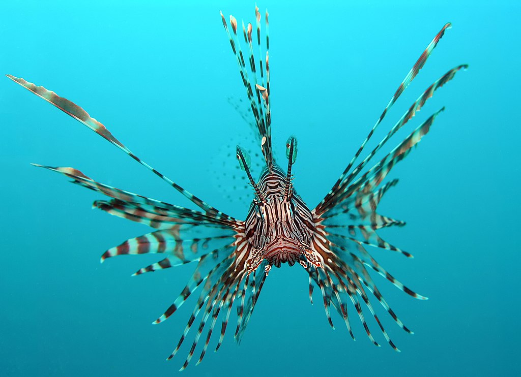
Indo-pacific lionfish Pterois volitans are among the most successful invasive species in human history. An adaptive management plan that considers local and regional action, as well as the impacts of management actions on socio-economic concerns, is necessary to address this complex issue and to ensure the latest science is incorporated into management. Along with collaborative partners from regional wildlife managers, NOAA, and the tourism industry, we are developing a decision support tool that incorporates information from field and laboratory experiments, bioenergetics models, and data sources that can be accessed and used by fisheries managers (survey, buoy, and satellite data).
Benthic production in the Northern Gulf of Mexico
Ecosystem-based management of marine and coastal resources in the Gulf of Mexico requires an understanding of the flow of energy through the food web, yet benthic production is rarely incorporated into ecosystem models. This project will develop a benthic production model for the northern Gulf of Mexico under various scenarios of hypoxia duration and severity. Field and laboratory experiments on key benthic species support the modeling effort.
Acidification in Australian mangrove forests

Previous work by the Glaspie lab found that long-term exposure to acidification in New South Wales, Australia altered trophic dynamics between crabs and oysters, which may have consequences for coastal food webs. In spring 2020, we are going back to the outback to take a second look on the impact of acidification on oyster quality and predator preference.
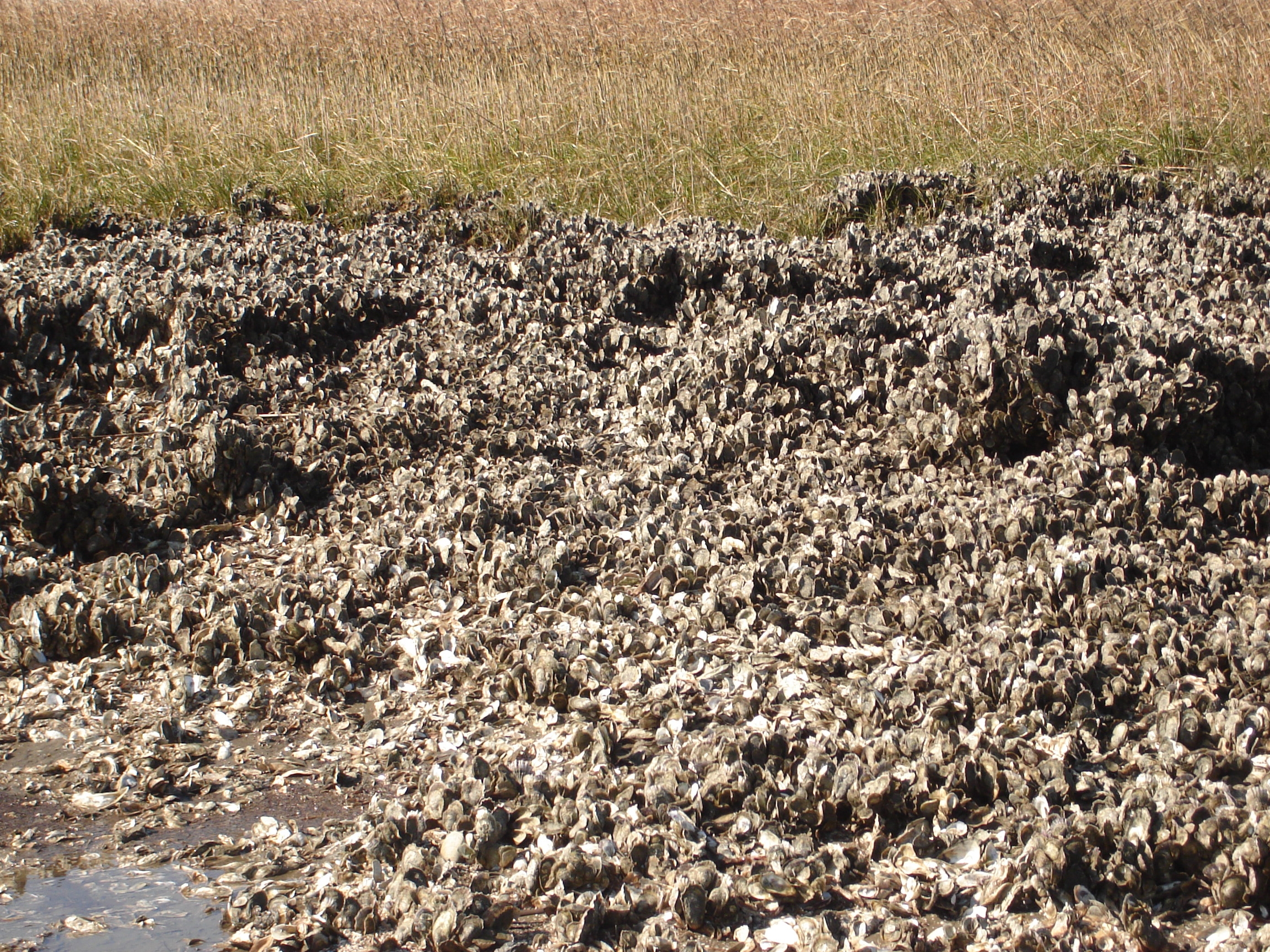
Impact of fluid mud on benthic invertebrates in dredge areas on the Louisiana shelf
A major component of the State of Louisiana’s effort to manage coastal land loss is to restore degraded barrier shorelines and beaches by introducing new sand to the coastal system from borrow areas. The overall goal of this study is to provide a comprehensive understanding of the contribution from non-linear sedimentation events (for this study, wave-supported fluid-mud) to pit infilling as well as its impacts on benthic ecology. In collaboration with George Xue, Kehui Xu, and Kanchan Maiti, we will collect field coring data to capture the wave-supported fluid-mud events and the benthic ecosystem’s response in spring, summer, fall, and winter when cold fronts prevail. These field data collections are designed to capture the evidence of non-linear sedimentation in the infilling sedimentations and their impact on benthic ecosystems.
User-driven tools to predict and assess effects of reduced nutrients and hypoxia on living resources in the Gulf of Mexico
The northern Gulf of Mexico (NGOMEX) experiences an annually recurrent region of summer hypoxia. Links between seasonal hypoxia in the NGOMEX and fish production are unclear, but managers and stakeholders alike need readily available and quantitative tools to predict the effects of planned nutrient reduction strategies aimed to minimize the hypoxic zone. This research examines the impact of hypoxia on trophic interactions between pelagic fish in the NGOMEX.
Incorporating habitat quality and climate into albacore tuna production estimates
There is some evidence that patterns of climate variability have impacts on habitat availability for albacore tuna. However, the impact of changing climate and current structure on habitat for albacore tuna is not fully understood because habitat quality for albacore tuna has yet to be quantitatively and mechanistically defined. We used a spatially explicit, bioenergetics-based modeling approach to quantify the quality of pelagic habitat for albacore tuna in the northern portion of the California Current, a highly variable region characterized by large scale climatic oscillations.
Marine benthic predator-prey interactions and global change

An understanding of the mechanisms by which habitat loss and storms impact predator-prey interactions may elucidate the fate of individual species in the face of global change. Field survey data, field caging experiments, laboratory mesocosm experiments, time-series analysis, and mathematical models were used to assess the role of habitat, major storm events, and predators on bivalve distribution in the lower Chesapeake Bay.
Ocean acidification and predator-prey interactions
Ocean acidification reduces the integrity of marine mollusk shells and interferes with predator-prey interactions. The effect of ocean acidification on predator-prey interactions was examined through two separate experiments: 1) using mud crabs and oysters acidified in situ in acid sulfate soil estuaries in New South Wales, Australia, and 2) using blue crabs and softshell clams acidified in the lab with CO2.